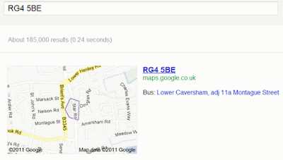
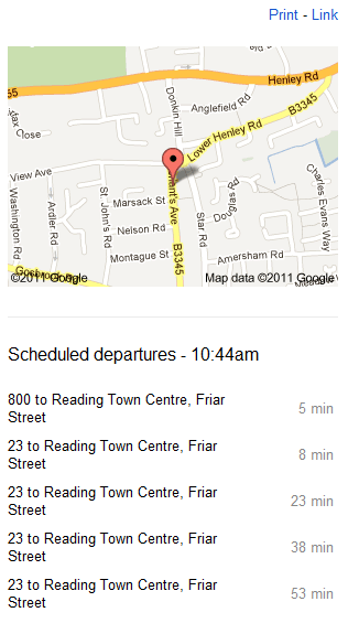
Although the boundaries are in roughly the right area, they are not accurate. In this example, the coverage of RG4 5BE extends north and south to the top and bottom of Star Road. Others have reported similar discrepancies in their areas. As a general indication of the location of a postcode area it is fine but do not rely on Google to identify which streets or parts of streets are covered by it. Google also gives information on the nearest bus stop, which in this case is correct but not the only option. If you click through to the full sized Google map the boundaries disappear and they do not appear at all if you do the search straight away within Google Maps. You do, though, see more information on the public transport options.
Alternative bus stops are given and the numbered routes listed. I was rather puzzled by the number 74 and 74 A, which have never seen, but a quick check revealed that it is the "football" bus that runs once a day and only when there is a match at the Madjeski Stadium. The scheduled times for the next buses are as accurate as the bus company timetables provided via Traveline and Transportdirect. I watched three buses arrive and compared it to Google's schedule: the number 800 was 7 minutes late, the first number 23 was 6 minutes late and the second on time so Google is not using real time data.
Overall, it's not bad. Just remember that the postcode boundaries are approximate so if you need something more precise use the Royal Mail web site. The bus timetable will not tell you if a bus is delayed or cancelled but if you are contemplating moving to the area it is a quick way of assessing how good (or bad) the local public transport is.


No comments:
Post a Comment